
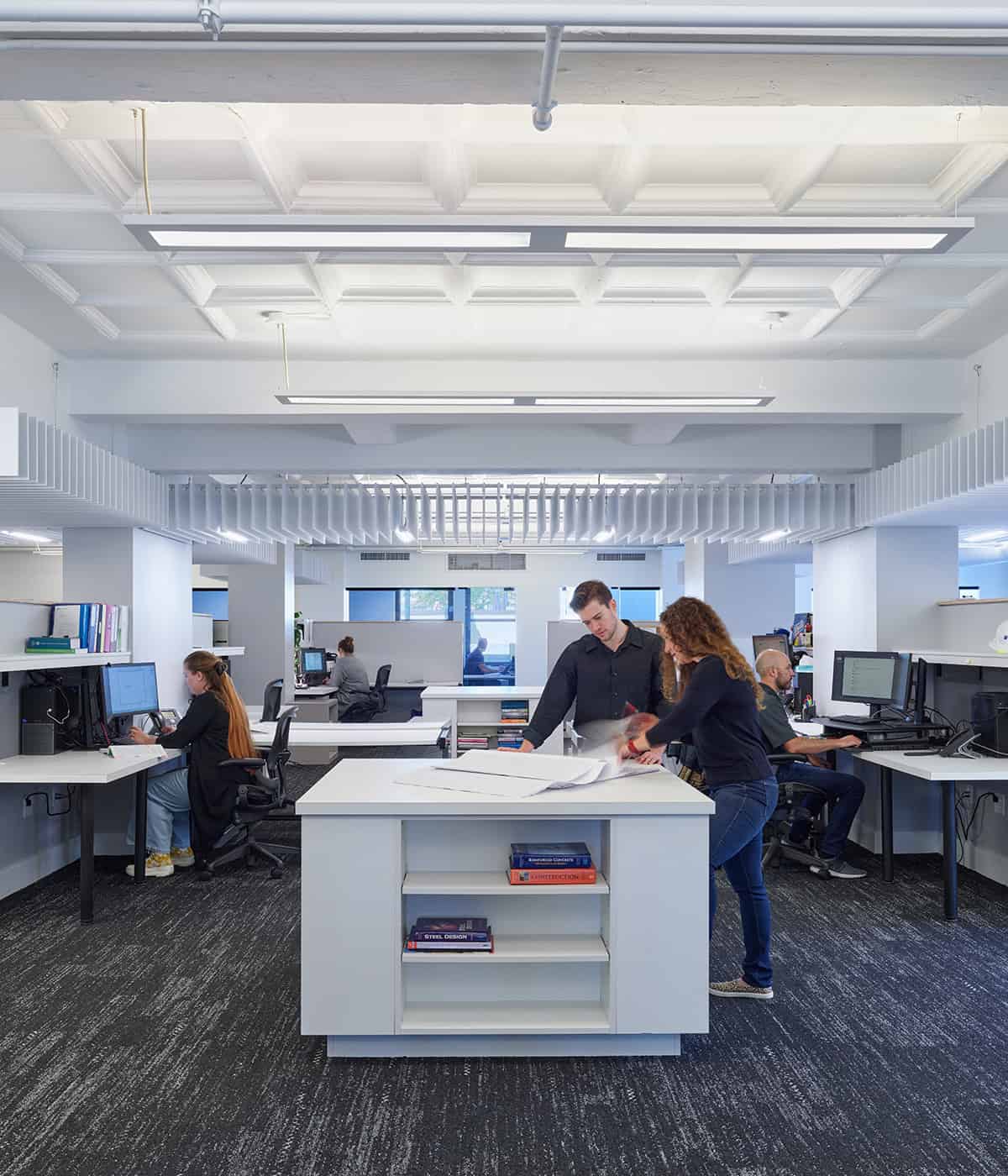


Civil Engineering
Shaping the ground we build on and the systems that make communities function.

Civil engineering is about more than infrastructure - it’s where vision meets reality.
It’s thoughtful, behind-the-scenes work that quietly powers the built environment. Our designs support resilience, sustainability and the everyday experiences of people moving through space. Our civil engineers work closely with owners, architects and municipalities to balance performance, constructability and long-term value.
Whether we’re navigating site constraints, regulatory hurdles or tight timelines, we bring a steady, thoughtful approach and a deep understanding of how decisions ripple through a project. We pride ourselves on being collaborative problem solvers and trusted partners.
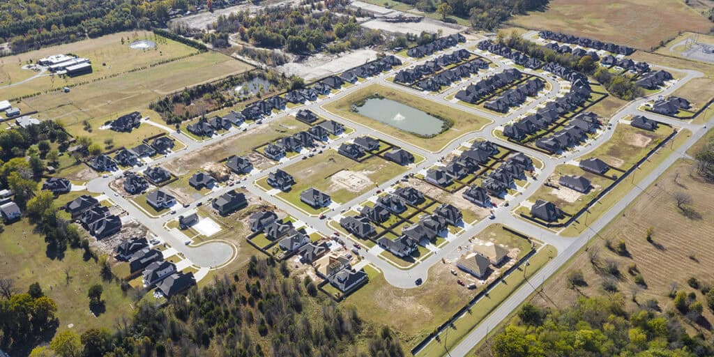
Site Design
site design
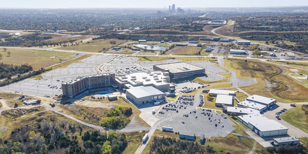
Site development civil engineering transforms raw land into construction-ready sites through comprehensive technical design and planning. Our approach encompasses grading and earthwork design to establish optimal building pad elevations and site drainage patterns, as well as utility infrastructure coordination for water, sewer, storm drainage and dry utilities. Additionally, we provide strategic parking lot and internal roadway layouts that provide efficient circulation and accessibility.
We design integrated stormwater management systems, including detention and retention facilities with water quality measures, while implementing erosion and sediment control strategies that protect your investment from day one. Our team navigates the full spectrum of regulatory requirements – from local zoning and environmental compliance to accessibility standards – helping your project comply with all codes while integrating seamlessly with existing surrounding infrastructure.
Pre-Design: Applying vision to the land to create possibilities.
- Due Diligence Reports
- Feasibility Studies
- Land Use Entitlement & Permitting
- Utility & Infrastructure Assessment
- Site Master Planning
- Watershed Planning
- Hydrologic & Hydraulic Studies
- Transportation Planning
- Traffic Studies
- Surveying & Mapping
Design: Melding engineering principles to the client’s vision of the project.
- Subdivisions & Land Development
- Civil Site Design and Analysis
- Erosion Control
- Stormwater & Flood Control
- Low Impact Development
- Detention & Retention Design
- Flood Risk Mitigation
- Dams & Levees
- DEQ, EPA, COE, USFW, FEMA Permitting
- Utility Relocations & Design
- Water Supply, Treatment & Distribution
- Water Flow & Pressure Analysis
- Sewer Collection, Pumping & Treatment
- Roadway Design
- Pavement Management
- Right-of-Way Plans & Documents
Construction: Geared toward compliance with the construction documents and design intent.
- Construction Cost Estimating
- Bid Solicitation & Bid Evaluation
- Contract Negotiations
- Construction Administration
- Construction Observations & Reports
- O & M Manuals
Other Services:
- Geographic Information Systems (GIS)
- Client Representation
- Community Engagement Meetings
- Expert Witness Testimony
Subdivision Design
subdivision design
Subdivision civil engineering transforms large parcels into thriving communities through comprehensive master planning and technical design, creating entirely new neighborhoods or districts. Our process begins with strategic lot layout optimization and the design of new public streets, built to proper geometric standards, which provide seamless connectivity to existing road networks while establishing efficient circulation patterns throughout the development.
We design complete utility infrastructure systems – including water distribution networks, sanitary sewer collection systems and storm drainage systems – all properly sized to serve the entire subdivision both now and as it grows. Our planning integrates recreational facilities, parks, trails and community amenities that enhance livability while adding long-term value to the development.
Pre-Design: Applying vision to the land to create possibilities.
- Due Diligence Reports
- Feasibility Studies
- Land Use Entitlement & Permitting
- Utility & Infrastructure Assessment
- Site Master Planning
- Watershed Planning
- Hydrologic & Hydraulic Studies
- Transportation Planning
- Traffic Studies
- Surveying & Mapping
Design: Melding engineering principles to the client’s vision of the project.
- Subdivisions & Land Development
- Civil Site Design and Analysis
- Erosion Control
- Stormwater & Flood Control
- Low Impact Development
- Detention & Retention Design
- Flood Risk Mitigation
- Dams & Levees
- DEQ, EPA, COE, USFW, FEMA Permitting
- Utility Relocations & Design
- Water Supply, Treatment & Distribution
- Water Flow & Pressure Analysis
- Sewer Collection, Pumping & Treatment
- Roadway Design
- Pavement Management
- Right-of-Way Plans & Documents
Construction: Geared toward compliance with the construction documents and design intent.
- Construction Cost Estimating
- Bid Solicitation & Bid Evaluation
- Contract Negotiations
- Construction Administration
- Construction Observations & Reports
- O & M Manuals
Other Services:
- Geographic Information Systems (GIS)
- Client Representation
- Community Engagement Meetings
- Expert Witness Testimony
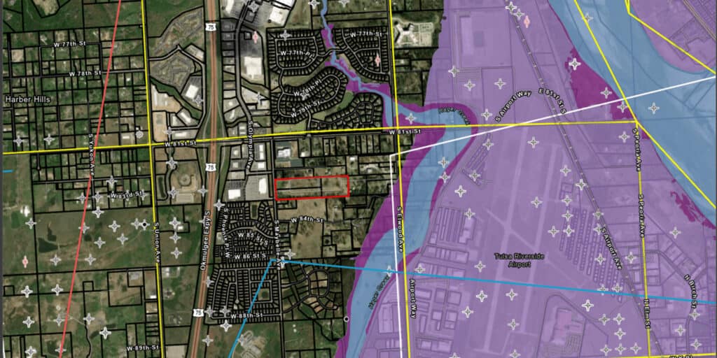
Hydrologic and Hydraulic Engineering
hydrologic and hydraulic engineering
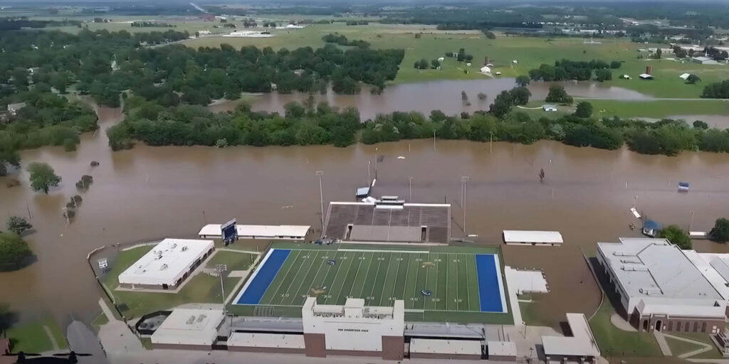
We embrace innovation and develop new solutions for both large-scale riverine flooding and localized community issues. We prioritize quality through effective, sustainable and long-lasting design in the face of increasingly severe weather events.
We go beyond traditional study and design services to deliver tangible benefits for your project. We can secure funding through FEMA grant applications and analyze the cost-benefits of FEMA and PL-566 grants. Additionally, we develop applications for Letters of Map Amendment, complete with elevation certificates. Our depth of skill and versatility allow us to successfully meet your unique project needs.
Planning:
- Master Drainage Plans
- Flood Risk Studies
- Flood Mitigation Feasibility Studies
- Regional Flood Plans
- Watershed Project Plans
- Dam and Levee Assessments
- Stormwater Utility Fee Programs
Design:
- Roadway Drainage
- Bridge Hydraulics
- Storm Sewer Drainage Systems
- Regional Detention Facilities
- Green Infrastructure/ Low Impact Development
- Multifaceted Flood Mitigation Solutions
- Mitigative Wetlands
- Streambank Restoration
- Dam and Levee Systems
Software:
Riverine Watershed Modeling
- HEC-HMS
- HEC-MetView
- HEC-SSP
- HEC-RAS (1-D and 2-D)
Hydraulic Structure Modeling
- NRCS SITES
- NRCS WinDAM
- FHWA HY-8
Storm Sewer Modeling
- Bentley CivilStorm
- EPA SWMM
- CHI PCSWMM (1-D and 2-D)
Mapping and Plotting
- ESRI ArcGIS Pro
- AutoDesk Civil 3D
- FEMA RASPlot
Permitting:
Dam Safety Compliance
- Permitting
- Hydrologic Sufficiency Assessments
- Breach Analysis and Reclassification
- Emergency Action Plans
- Operation and Maintenance Plans
Regulatory Floodplain Compliance
- Community Floodplain Development Permits
- Letters of Map Revision (CLOMR and LOMR)
Geographic Information Systems (GIS)
geographic information systems
Our team unlocks the power of location intelligence by creating, managing, analyzing, and mapping data in ways that traditional methods simply can’t. Whether you’re optimizing resources, assessing risk, or planning for the future, GIS provides the insights to make smarter choices.
We offer services ranging from digitization and data entry to cartography and map production, extending to advanced geoprocessing, spatial analysis, and geospatial data science. We handle GIS projects comprehensively from inception to completion.
We provide GIS for many sectors including oil and gas, transportation, infrastructure, power, waste and water, government and municipalities, planning, utilities, retail, school districts, healthcare campuses and more.
Data Collection: We tailor your data to your specific requirements. Our capability to work with a variety of different data formats means we can work with just about any data sent our way. A specialized spatial database offers tailored management, processing and analytical tools designed for intricate geospatial data. These databases are expanded to accommodate spatial data types and queries.
We have experience in crafting and implementing file-based and server-based databases, whether on-site or in cloud environments. Some examples of spatial databases we work with include ESRI File Geodatabase, ESRI Personal Geodatabase and ESRI Enterprise Geodatabase (ArcSDE).
Mapping and Visualization: GIS-based web mapping represents an innovative technology enabling users to access and engage with spatial data via the internet.
Going beyond the limitations of traditional static maps, web mapping democratizes spatial data accessibility, catering to a broad spectrum of users beyond GIS professionals. These interactive maps incorporate real-time data, fostering collaboration and sharing.
From data visualization to analytics and cloud-based data storage, we provide comprehensive support to leverage the full potential of web mapping technology.
Pavement Management
pavement management
Well-maintained pavement is essential in preserving the value of a property. A typical parking lot or service road will last about 20 to 30 years before it deteriorates into a safety hazard. However, sometime before that, the lot will no longer provide an acceptable serviceability.
Our pavement management services provide a proactive approach to maintaining your valuable assets. We analyze your pavement network, identify potential issues, and develop customized solutions that address your specific needs and budget.
Many property owners and managers can benefit from a one-time repair of their pavement, while others may benefit more from a comprehensive analysis of their pavement network. Our pavement management system prioritizes localized failures for budgeting purposes and to maximize maintenance dollars.
Our team can update an existing pavement management program or develop a new system. We can customize the entire pavement maintenance and rehabilitation requirements of multiple facilities. Our services correspond to the individual operational needs of each client on a site-by-site basis.
More than grading plans and drainage models - it’s about shaping places people depend on.
All Civil Engineering Projects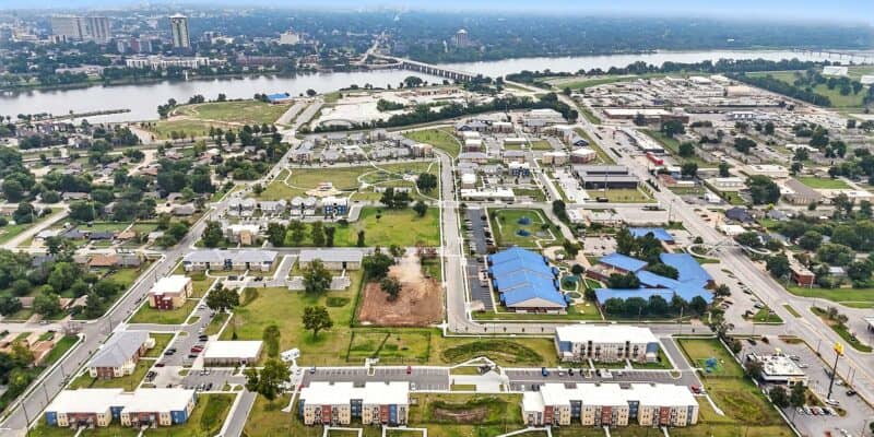

Featured Insights

Celebrating 30 Years in Kansas City
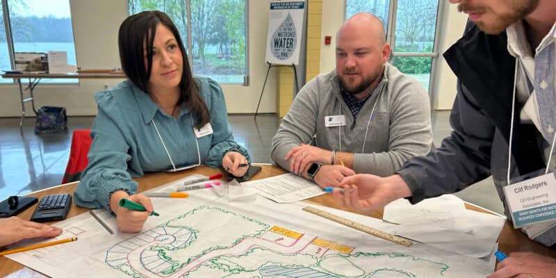
Team Takeaways: Navigating Water and Growth in NWA

A Labor of the Heart