





Building a Clearer Picture of Your Infrastructure: How GIS Connects the Data
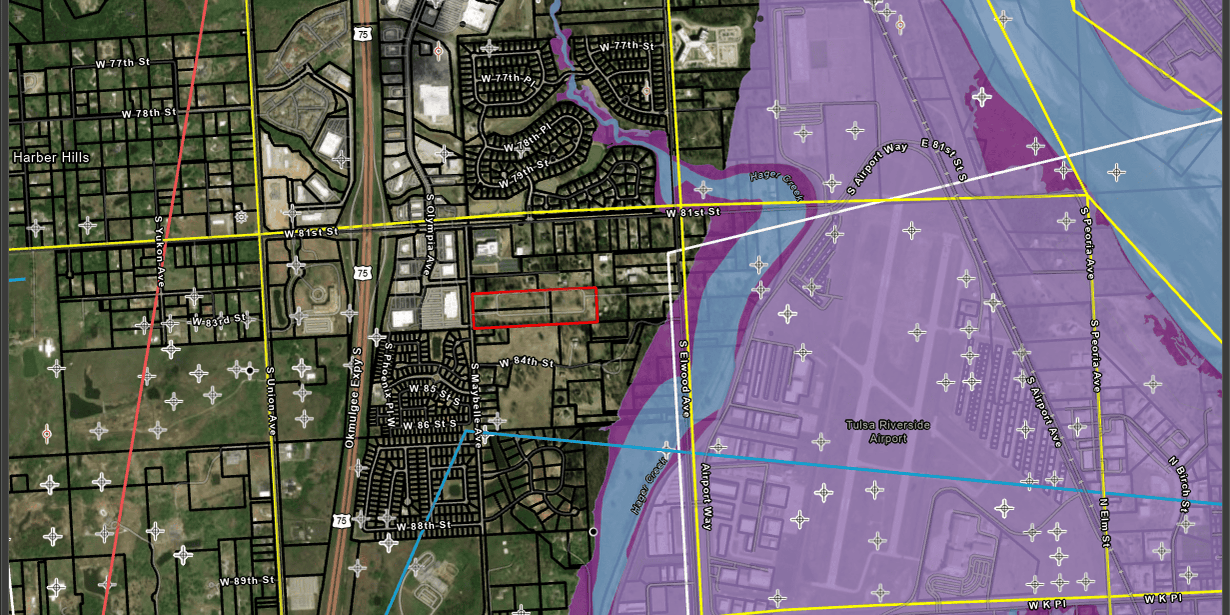
Managing public infrastructure requires understanding what exists, where it is located and how individual systems relate to one another.
Roads, water and sewer lines, drainage systems and public facilities all contribute to a community’s operations, but the information about these assets may be maintained in different formats or across multiple departments.
Geographic information systems (GIS) help bring this information together in a geographic context. By connecting data to physical locations, GIS gives municipalities and infrastructure managers a clearer view of their assets, reveals relationships between systems and supports more informed planning and decision-making.
Why a Clear Picture of Infrastructure Matters
Infrastructure decisions are only as informed as the information available to support them. When asset records, maps and maintenance information are difficult to access or compare, it can be challenging to understand existing conditions, identify information gaps or coordinate improvements.
GIS provides a way to organize location-based information so teams can view infrastructure in relation to surrounding features and other relevant data. Depending on the information available, this may include asset locations, system characteristics, maintenance records, topography, drainage patterns and planned improvements.
Bringing these layers together helps teams move beyond isolated records to better understand the broader context in which infrastructure operates.
How GIS Helps Connect Infrastructure Data
Bringing Different Data Sources Together
Infrastructure information can come from many sources, including existing maps, spreadsheets, field data, engineering records and digital databases. GIS can bring compatible information into a shared spatial environment, helping teams organize and analyze data that might otherwise remain disconnected.
The process may also reveal gaps, inconsistencies or outdated records that need attention. Identifying these limitations is an important step toward building a more useful and reliable picture of existing infrastructure.
Understanding How Systems Relate
Infrastructure rarely operates in isolation. Roads intersect with underground utilities, drainage systems affect nearby properties and public facilities depend on surrounding infrastructure.
GIS allows teams to view these relationships geographically. This perspective can help identify areas that warrant further investigation, inform coordination between departments and provide useful context when evaluating proposed improvements.
Making Information Easier to Access and Use
A map can make complex information easier to interpret, particularly for people who don’t work with spatial data every day. GIS-based mapping and web mapping tools can help make relevant information accessible to engineers, public works staff, planners and other stakeholders.
Interactive maps can also support collaboration by giving teams a shared view of selected data, rather than requiring everyone to interpret separate records or static maps.
From Infrastructure Data to Better Planning
Once information is organized and accessible, it can support a range of planning activities. Depending on the data available and the analysis performed, GIS can help teams examine infrastructure conditions, understand watershed and drainage characteristics, identify potential conflicts and evaluate how proposed improvements relate to existing systems.
For municipalities, this information can contribute to maintenance planning, capital improvement planning and coordination across departments. GIS does not replace field assessments, engineering judgment or asset management processes. Instead, it provides another tool for understanding infrastructure and supporting decisions with a clearer view of the available information.
Questions to Ask About Your Infrastructure Data
Organizations looking to make better use of GIS can start with a few questions:
- Where is our infrastructure information stored? Identify the maps, databases, spreadsheets and records currently in use.
- How complete and current is our data? Determine whether asset information is accurate, consistent and suitable for the decisions being made.
- Can we view related systems together? Consider how connecting information across departments could improve coordination and planning.
- Who needs access to this information? Identify the people who would benefit from shared maps, spatial data or web-based tools.
- How will the information be maintained? Establish processes for updating records as infrastructure changes and new information becomes available.
Answering these questions can help clarify where GIS may add value and what steps are needed to make infrastructure information more useful.
GIS in Practice: Connecting Data for Community Planning
As part of the City of Ada Comprehensive Plan, Wallace Design Collective used GIS to map existing conditions, evaluate service coverage and support future land use and infrastructure planning.
The work brought together several layers of information to help the city better understand its current needs and identify opportunities for future growth.
- Infrastructure and utilities: Mapped water and sewer networks and incorporated averaged traffic count data to establish baselines for future utility expansions.
- Emergency services: Mapped police and fire stations with service-area buffers to help identify potential coverage gaps and inform City Council funding decisions.
- Parks and recreation: Mapped 0.5-mile, 1-mile and 5-mile service areas around parks to identify gaps and help guide proposed park locations.
- Existing land use: Mapped current land use, zoning designations and spatial patterns to establish a baseline of existing conditions.
- Parcel and future land use analysis: Refined parcel data and identified vacant or underutilized residential parcels to support the Future Land Use Map, future zoning updates and annexation policies.
Together, these GIS applications connected information across city systems and translated existing conditions into a clearer foundation for planning. Rather than viewing utilities, public services, parks and land use separately, the city could consider how these elements relate to one another when evaluating future needs.
Frequently Asked Questions About GIS and Infrastructure
How is GIS used in infrastructure management?
GIS organizes location-based information about infrastructure and related features, helping organizations visualize assets, understand spatial relationships and support maintenance and planning decisions.
How can GIS support capital improvement planning?
GIS can help municipalities view infrastructure alongside other relevant information, identify potential service gaps and understand where proposed improvements relate to existing systems. The usefulness of the analysis depends on the quality of the available data and the questions being evaluated.
What is the difference between GIS mapping and a traditional map?
A traditional map typically presents a fixed view of geographic information. GIS can connect mapped features to underlying data, allowing users to analyze relationships, combine information layers and update views as information changes.
Creating a More Informed View of Infrastructure
When infrastructure information is scattered across maps, databases and departments, it can be difficult to see how individual systems connect. GIS provides a geographic framework for organizing that information, exploring relationships and supporting more informed planning decisions.
Wallace Design Collective’s GIS team works with varied data formats, spatial databases, geoprocessing tools and mapping technologies to help clients manage, analyze and visualize geospatial information. From organizing existing records to developing interactive maps, our team helps make location-based information more accessible and useful.
Looking for a clearer picture of your infrastructure? Connect with our team at info@wallace.design to discuss how GIS can help organize your data and support your planning needs.
Before You Buy: What Owners Need to Know About Development Property
What Is an ALTA/NSPS Land Title Survey and When Do You Need One?

Who We Are and What We Do: Land Surveying